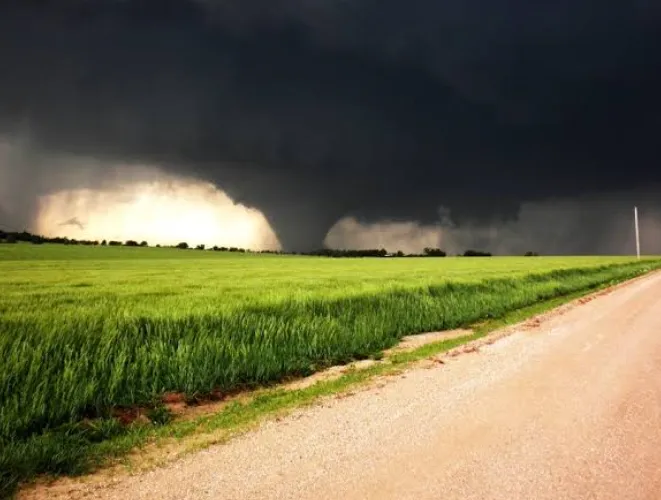
Wind shear can change a storm in minutes. It helps storm chasers see how air moves at different heights and whether a storm may gain spin. On tornado tours USA 2027, reading these patterns adds more meaning to what happens in the sky. A warm, moist surface layer may feed a storm, while stronger winds above can tilt and turn it. The result is a setup worth watching. Good shear analysis does not promise a tornado. It helps explain why some storms become more organized than others.
Read Wind Direction At Different Heights
Wind shear starts with a simple check: compare wind speed and direction near the ground with winds higher up. If both stay nearly the same, a storm may remain less organized. A clear change in speed or direction can create a better setting for rotation. Chasers watch this change with weather data, radar, and field reports. The pattern matters more than one wind reading. Small shifts can build into larger effects. Weather teams often track the change layer by layer, because storms respond to the full air column, not one level.
Spot Rotation Friendly Wind Profiles Early
A key part of Kansas storm chasing tours 2027 is learning how wind profiles can support storm rotation. When winds turn with height, the air can create horizontal spin. A strong thunderstorm may then tilt that spin upward through its rising air. This process can help form a rotating updraft. The shape of the wind profile matters too. Smooth changes can support steady storm growth, while messy or weak patterns may limit it. Chasers do not read shear alone. They combine it with moisture, heat, instability, storm movement, and radar trends.
Connect Shear with Storm Structure
Wind shear becomes easier to understand when paired with storm shape. Strong shear can help a storm keep its updraft separate from falling rain and hail. That separation may allow the storm to last longer. A rotating supercell often shows a tall, organized structure, though every storm has its own look. Radar can reveal curved or rotating features that deserve close attention. Surface observations add another layer. Changes in temperature, wind, and pressure can help explain what the storm is doing. None of these clues should stand alone. Together, they form a clearer view.
Watch Low-Level Shear Closely
Low-level shear deserves special attention because it can affect the area close to the ground. Winds that change speed or direction within the lowest part of the atmosphere may increase the storm’s ability to develop a strong rotating circulation. Chasers often compare surface winds with winds just above the ground. Moist air can add fuel, while a steady inflow may keep the storm supplied. Still, strong low-level shear does not mean a tornado must form. Storm timing matters. Boundaries matter too. A small change near the storm can alter its whole path.
Use Radar and Maps Together
Radar gives a moving view of storms, while maps show the larger wind setup around them. Looking at both helps chasers connect what they see with what the atmosphere is doing. Doppler radar can show wind motion inside a storm. Weather maps can show pressure, fronts, moisture, and wind fields across a wider area. GPS and road maps also matter during field travel. A storm may look close on a screen but be far away by road. Safe routes need planning. The best chase decisions balance storm science with distance, roads, visibility, and time.
Know When Shear Signals Change
Storm environments can shift fast, especially across the Plains. A wind profile that looks favorable in the morning may change by afternoon. New boundaries can form as storms develop. Winds may strengthen, weaken, or turn. That is why chasers keep checking fresh data instead of relying on one forecast. During tornado tours USA 2027, visitors can learn how these updates shape chase decisions. The same idea applies across Kansas storm chasing tours 2027, where changing weather can turn a quiet setup into an active one. Good interpretation means watching the trend, not one snapshot.
Conclusion
Understanding wind shear makes storm chasing more than a search for dramatic skies. It gives each storm a story. Speed changes, wind direction, moisture, radar signs, and storm structure all fit together like parts of one moving system. Visitors can gain much more from a chase when they know what those signals mean. For clear weather insight and practical storm knowledge, stormchasing.com offers a useful place to learn. The sky may change quickly, but careful observation helps explain those changes and makes every chase more informed, focused, and memorable.